Rushcliffe Golf Club: Is this the most nature-rich golf course in Nottinghamshire?!
See what you think from this account of the habitats and biodiversity at Rushcliffe Golf Club, a feature of the course the club is working to preserve.
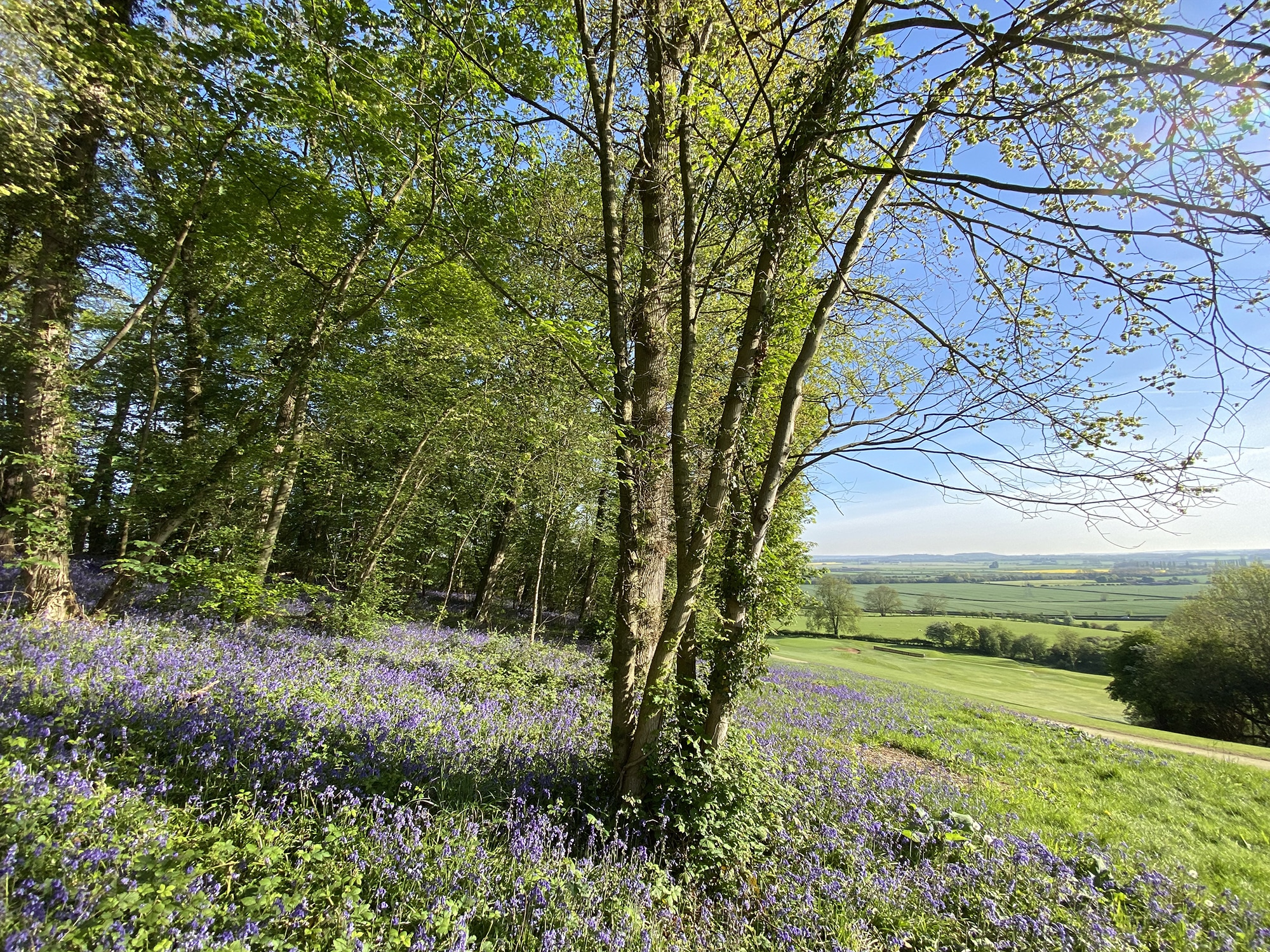
Rushcliffe Golf Club near East Leake in Nottinghamshire, established in 1909, lies on a beautiful, hilly and wooded site with marvellous views across countryside towards Nottingham.
A new club initiative is to increase awareness of the need for sustainability at the club in the areas of energy emission, water management, the use of resources, and to gain a better understanding of its biodiversity and habitats.
A part of this initiative is to get to grips with what we have in the way of biodiversity and habitats and the reasons why they are so varied. This account is an outline of some of the known habitats and their typical plants, birds and mammals. We intend to develop this knowledge by carrying out a wildlife survey with advice from Nottinghamshire Wildlife Trust and other voluntary organisations, as a basis for better habitat management of the more “wild” places adjacent to the playing areas.
Of the 160 acres of land owned by the club, around 60% of it is maintained for the playing areas. The remainder is natural vegetation, including 44 acres of woodland and rough grassland designated by Natural England a Site of Special Scientific Interest (SSSI) for its exceptional plantlife. On this basis it is clear that the biodiversity of a large area of the course is of considerable wildlife potential.
The main topographical feature of the course is a steep north east-facing slope, or escarpment formed from rocks of late Triassic to early Jurassic age (215 to 200 million years old), running through the course, rising about 40 metres from low ground in the north east to a flat plateau in the south west. It is this feature which largely dictates the biodiversity of the course and its fantastic variety of wildlife.
Course biodiversity is dependent largely on two factors, the composition of the sub soil and the past land-use.
Composition of the ground
The sub soil (geology) of the course is dominated by sticky red clays on the low ground in the north east and on much of the escarpment. Deeper down this becomes harder red mudstone within which layers of gypsum occur and were formerly mined beneath parts of the escarpment. A former mine entrance in a deep cutting close to the 17th fairway is an interesting, if largely hidden, feature of the course.
The top part of the steep escarpment slope and adjacent flatter ground to the west contain relatively hard, thin layers of limestone which give rise to a rare lime rich soil. Elsewhere on this flatter ground above the escarpment are some gravels and clays which came from an ice sheet which covered the area about 500,000 years ago.
Past land-use
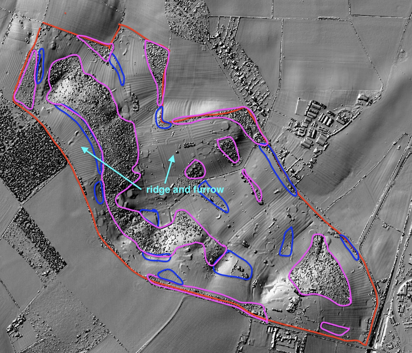
Before the golf course came along the land was farmed, although because it is so steep the escarpment was probably never cultivated, being rough scrub and gorse grazed by sheep. Evidence of ancient cultivation on the flatter ground is ridge and furrow strips, (parallel undulations some 5 to 8m wide and a metre or so in height). These were formed by repeated ploughing, and date perhaps from Anglo Saxon time in the 10th century. There were no field boundaries then, and the land was farmed as “open fields”, a system particularly common in the English Midlands. The land was progressively enclosed by hedges and wooden fencing during the middle ages when animal farming became more lucrative, and in the late 1700s the land was fully enclosed by hedges following an Act of Parliament which stipulated where hedges would be grown. The hedges were almost entirely of hawthorn with sporadic elm and ash trees which were allowed to grow to maturity and/or periodically pollarded for a variety of uses. One or two ancient ash trees on the course, now on their last legs, date from this time, and the present large areas of hawthorn spinney are overspill from the original hawthorn hedges. The fact that ridge and furrow is preserved over much of the course playing areas suggests that after the enclosure no substantial ploughing of arable land has taken place, and quite likely the fields were largely turned to grassland enabling a good variety of wild flowers to thrive. It is this history of land use that has given the course its unique character.
Woodland dominates the escarpment. It has for the most part grown since the course was opened in 1909. Old maps from 1794 and 1826 and the first Ordnance Survey map of about 1890 show the escarpment to be scrubby land with only small patches of woodland. However back in the middle ages it is likely there was more extensive ancient woodland, as shown by the types of wildflowers in the woodland margins: bluebells, stitchwort and wood anemone amongst other species being ancient woodland indicators. In other areas of the course woodland is mainly of hawthorn, which has proliferated in unused areas. Stands of pine and poplar trees were both planted since 1909, the latter now reaching the end of their life, the rotting wood from which forms a good ground habitat. In the past 10 years or so many trees, including pine and oak have been planted on the margins of the playing areas, some designed to come to maturity once the present poplar trees have died, others to enhance the course landscape.
The course today
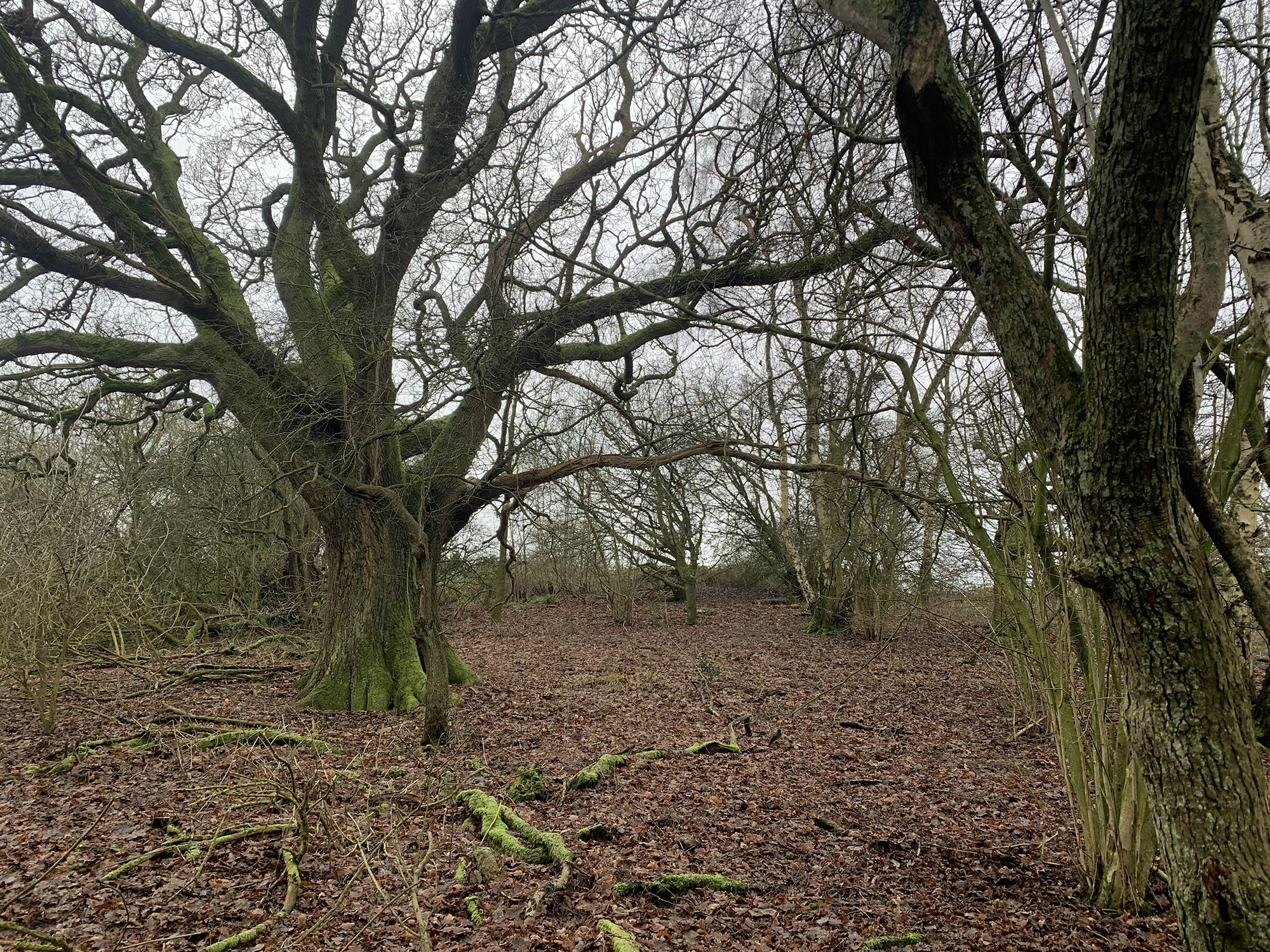
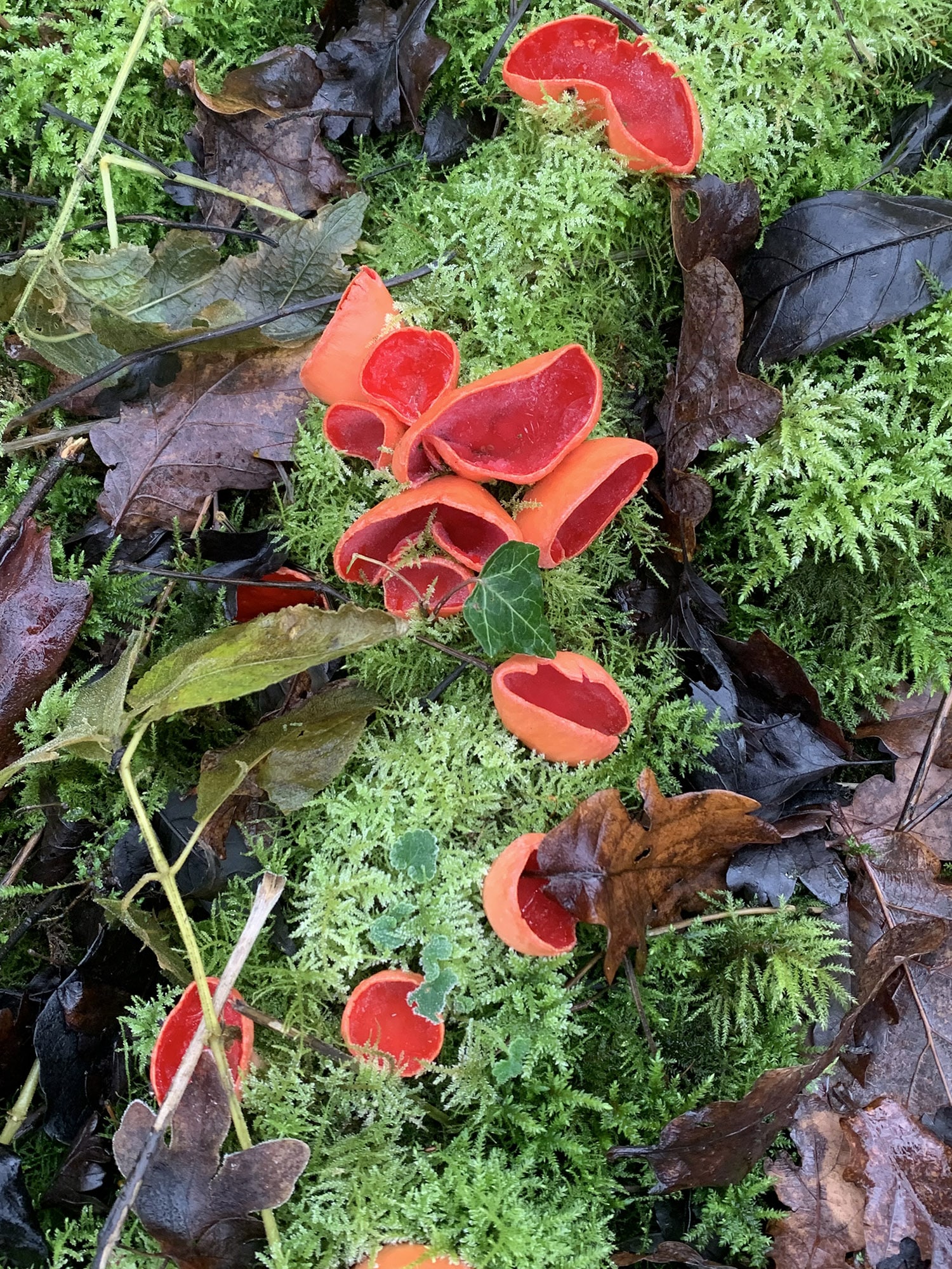
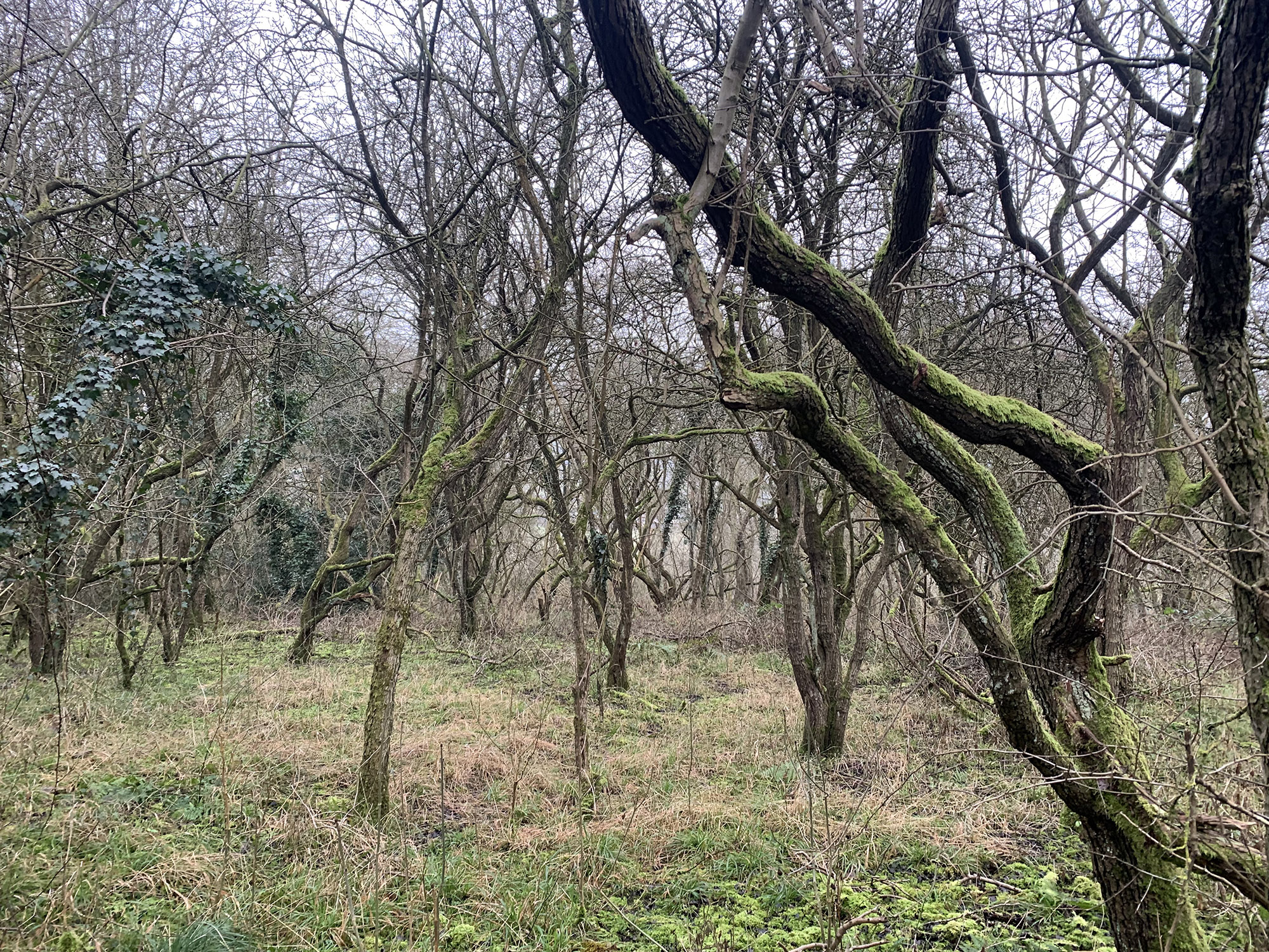
The escarpment itself has several different tree communities, including undisturbed areas dominated variously by oak trees, birch trees, hawthorn spinneys and bramble scrub, and a few coppiced hazel trees (photos). The woodland understory, being well away from the playing area, is characterised by large ferns, rotting branches of fallen trees and leaf litter. It is likely that a good variety of fungi occur there, including the luminous Red Elf Cap (photographed).
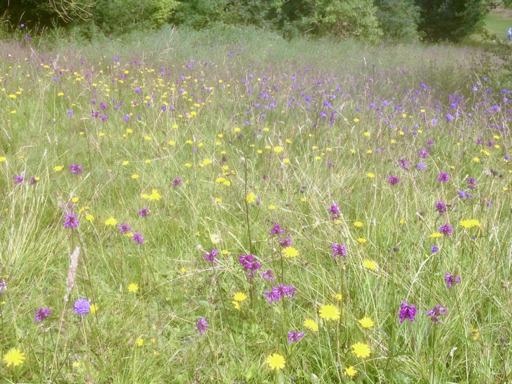
Along the top of the escarpment significant areas of rough grassland alongside fairways have a mixture of calcareous, neutral and acidic soils, the principal feature for the Site of Special Scientific Interest (SSSI) designation. A colourful spread of thousands of purple betony, blue milkwort, purple devils bit scabious, yellow vetches, lady’s bedstraw and an occasional orchid light up the grass from spring until autumn (photos). Rare grasses are also noted in the Natural England SSSI designation. In addition, neutral to calcareous grassland on the lower ground is notable for dense spreads of cowslip and, particularly around drainage ditches, primrose.
As might be expected from such a wide variety of habitats, bird life is varied. Of the predatory species, Buzzard, Kestrel, Sparrowhawk and Tawny Owl breed. Amongst other species seen and heard annually are Willow Warbler, Chiffchaff, Garden Warbler, Whitethroat, Treecreeper, Nuthatch and Greater Spotted Woodpecker. The course is also a haven for butterflies, the more unusual species being Silver Washed Fritillary and White Letter Hairstreak both of which have specialised needs in order to breed. Even though water bodies are few, every late summer tens of Migrant Hawker dragonflies hunt on the wing for insects in sheltered, sunny glades on the escarpment edge.
The future vision
Initiatives are already underway to enhance the various habitats are bird and bat boxes in the woodland, making woodpiles, and scrub clearance to increase light for the benefit of bluebells. There are now plans to seed areas of wildflowers at the top of the escarpment, and advice is being sought about how much bramble scrub could be sensibly removed from un-wooded parts of the escarpment, to improve wildflower habitat while maintaining song bird nesting areas.
The next steps are to carry out surveys to understand, for example, the proportion and composition of various tree species, habitats of the butterflies and dragonflies, mammal distribution (muntjac, badger, fox, and hare are seen regularly), and the number and variety of bird species. At the same time we have to continue with our obligation to Natural England to manage the stunning grassland plant communities for the next generations of golfers to enjoy.
For further information, please contact Richard Ellison at r.a.ellison@icloud.com

